Quantum GIS 2.18.9
Cross-platform and user friendly Open Source Geographic Information System (GIS)
Cross-platform and user friendly Open Source Geographic Information System (GIS)
Software Specs
Publisher:............ Gary Sherman
License:............... GPL
File size:.............. 330752 MB
Downloads:.........
Release date:...... 10 Oct 2012
Last update:........ 29 May 2017
Publisher review for Quantum GIS 2.18.9:
Review by: Gary Sherman
QGIS supports vector, raster, and database formats and lets you browse and create map data on your computer.
Quantum GIS (QGIS) supports many common spatial data formats (e.g. ESRI ShapeFile, geotiff). QGIS supports plugins to do things like display tracks from your GPS.
QGIS aims to be an easy to use GIS, providing common functions and features. The initial goal was to provide a GIS data viewer. QGIS has reached that point in its evolution and is being used by many for their daily GIS data viewing needs. QGIS supports a number of raster and vector data formats, with new support easily added using the plugin architecture.
Requirements:
The raster georeferencer plugin requires the GNU Scientfic Library (GSL).
SQLite is always required.
The Expat XML Parser is required for the GPS plugin.
Qt 4.2.2 is required (comes with the installe
Operating system:
Windows All

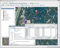
Quantum GIS screenshots:
Quantum GIS download tags:
geographic information system map creator map viewer geographic information create
Copyright information:
SPONSORED LINKS
Based on 5 ratings. 5 user reviews.
WSUS Offline Update
Popup Workshop - The Best Web Hover Ad Generator
3S Accounting
Cash Counter
IOREG
AMC Reporter
Speed Bid for eBay
Chilkat FTP C++ Library
Banker
MIETrak
Accounting and Finance
Office Suites and Tools
Inventory and Barcoding
PIMS and Calendars
Databases and Tools
Project Management
Helpdesk and Remote PC
Calculators and Converters
Vertical Market Apps
Investment Tools
Math and Scientific Tools
Other
Timesheets MTS Software
Softvoile
NewFreeDownloads
Office Suites
PIMS
Math
Calculators
Helpdesk
Databases
Accounting
Inventory